



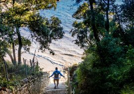
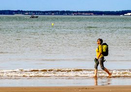




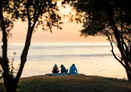
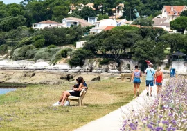


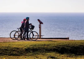


Whether on foot, by bike, or even on horseback, the Royan region is perfect for hiking. Choose from short family walks to discover our most beautiful villages or nature trails in the Coubre forest. Royan Atlantique offers a multitude of trails for all levels. We invite you to follow our hiking routes and explore the heritage of our region at your own pace.
-
Itinéraire VTC N°10 – De La Tremblade à La Palmyre
Level suitable for beginners

Mountain biking route No. 10 – From La Tremblade to La Palmyre, © Thierry Avan See the route
-
Boucle équestre N°3 – Forêt de la Coubre
Level reserved for experts/experienced
-
Photo 1, © Thierry Avan -
Photo 2, © Thierry Avan -
Photo 3
See the route
-
-
Circuit VTT N°10 – Semussac
Moderate level
-
Photo 1 -
Photo 2 -
Photo 3
See the route
-
-
Sentier Détours N°1 – Arvert
Level suitable for beginners

Detours Trail No. 1 – Arvert, © Thierry Avan See the route
-
Circuit VTT N°11 – Arces
Easy level
-
Photo 1 -
Photo 2 -
Photo 3
See the route
-
-
PR N°7 – Floirac
Level suitable for beginners
-
Photo 1, © Thierry Avan -
Photo 2, © Destination Royan Atlantique -
Photo 3, © Thierry Avan
See the route
-
-
Circuit VTT N°8 – Mortagne-sur-Gironde
Difficult level
-
Photo 1 -
Photo 2 -
Photo 3
See the route
-
-
Circuit VTT N°9 – Boutenac-Touvent
Moderate level
-
Photo 1 -
Photo 2 -
Photo 3
See the route
-
-
Sentier Détours N°3 – Breuillet
Level suitable for beginners

Detours Trail No. 3 – Breuillet, © Thierry Avan See the route
-
Boucle équestre N°1 – Forêt de la Coubre
Level reserved for experts/experienced
-
Photo 1 -
Photo 2 -
Photo 3, © Thierry Avan
See the route
-
-
Circuit VTT N°14 – Saujon
Easy level
-
Photo 1, © Thierry Avan -
Photo 2
See the route
-
-
Sentier Détours N°1 – Ronce-les-Bains
Level suitable for beginners
-
Photo 1 -
Photo 2 -
Photo 3
See the route
-
-
Sentier Détours N°2 – Saujon
Level suitable for beginners
-
Photo 1, © Thierry Avan -
Photo 2, © Thierry Avan -
Photo 3, © Thierry Avan
See the route
-
-
PR N°9 – Saint-Georges-de-Didonne
Level suitable for beginners
-
Photo 1, © Thierry Avan -
Photo 2, © Thierry Avan -
Photo 3, © Thierry Avan
See the route
-
-
Sentier Détours N°2 – Meschers-sur-Gironde
Level suitable for beginners
-
Photo 1 -
Photo 2, © Thierry Avan -
Photo 3, © Thierry Avan
See the route
-
-
Itinéraire VTC N°12 – De Saujon à Médis
Level suitable for beginners
-
Photo 1, © Thierry Avan -
Photo 2, © Thierry Avan -
Photo 3, © Thierry Avan
See the route
-
-
Itinéraire VTC N°5 – De Cozes à Barzan-Plage
Level suitable for beginners
-
Photo 1, © Thierry Avan -
Photo 2, © Thierry Avan -
Photo 3, © Thierry Avan
See the route
-
-
PR N°25 – Saint-Romain-de-Benet
Level suitable for beginners
-
Photo 1, © Thierry Avan -
Photo 2, © Thierry Avan -
Photo 3, © Loopi
See the route
-
-
Sentier Détours N°1 – Meschers-sur-Gironde
Level suitable for beginners
-
Photo 1 -
Photo 2, © Thierry Avan -
Photo 3
See the route
-
-
-
Church of Our Lady of Rioux -
Roman church -
Church of Our Lady of Rioux -
Rioux Market Halls
See the route
-
-
Balade n°9 – Marais doux et marais de la Seudre – GRAVEL et VTT
Level reserved for experts/experienced
-
Photo 1, © CARA -
Photo 2, © CARA -
Photo 3, © CARA -
Photo 4, © CARA
See the route
-
-
Circuit VTT N°1 – Les Mathes – La Palmyre
Easy level
-
Photo 1 -
Photo 2 -
Photo 3
See the route
-
-
Balade n°3 : Entre Seudre et Atlantique – GRAVEL et VTC
Level suitable for beginners
-
Photo 1, © Thierry Avan -
Photo 2, © Thierry Avan -
Photo 3, © Thierry Avan
See the route
-
-
Sentier de la Loge – Forêt de la Coubre
Level suitable for beginners
-
Photo 1 -
Photo 2 -
Photo 3
See the route
-
-
PR N°22 – Étaules
Level suitable for beginners
-
Photo 1, © Destination Royan Atlantique -
Photo 2, © Loopi -
Photo 3, © Loopi
See the route
-
-
Sentier Détours N°1 – Vaux-sur-Mer
Level suitable for beginners
-
Photo 1, © Thierry Avan -
Photo 2, © Thierry Avan -
Photo 3, © Thierry Avan
-
-
Le Chemin de Saint-Jacques de Compostelle
Level reserved for experts/experienced
-
Photo 1, © Thierry Avan -
Photo 2, © Thierry Avan -
Photo 3, © Thierry Avan -
Photo 4 -
Photo 5
See the route
-
-
Sentier de liaison : du sentier du Gardour à celui des Roseaux
Level suitable for beginners

Connecting path: from the Gardour path to the Roseaux path -
Balade n°4 (saisonnière) – Entre Seudre ostréicole et côte atlantique – GRAVEL et VTC
Level reserved for experts/experienced
-
Photo 1, © Thierry Avan -
Photo 2, © Destination Royan Atlantique -
Photo 3, © Thierry Avan
See the route
-
-
Balade n°2 – Entre marais doux et marais de la Seudre – GRAVEL et VTC
Level suitable for beginners
-
Photo 1, © Thierry Avan -
Photo 2, © Thierry Avan -
Photo 3, © Thierry Avan
See the route
-
-
Sentier Détours N°2 – Mornac-sur-Seudre
Level suitable for beginners
-
Photo 1 -
Photo 2 -
Photo 3
See the route
-
-
Sentier Détours N°2 – Mortagne-sur-Gironde
Level suitable for beginners
-
Photo 1 -
Photo 2 -
Photo 3
See the route
-
-
Sentier Détours N°1 – Saint-Georges-de-Didonne
Level suitable for beginners
-
Photo 1 -
Photo 2, © Thierry Avan -
Photo 3, © Thierry Avan
See the route
-
-
Sentier des 4 Fontaines – Forêt de la Coubre
Level suitable for beginners
-
Photo 1 -
Photo 2 -
Photo 3
See the route
-
-
Sentier du Requin – Forêt de la Coubre
Level suitable for beginners
-
Photo 1 -
Photo 2 -
Photo 3
See the route
-
-
Sentier de liaison : du sentier des Rochelais à celui du Gardour
Level suitable for beginners

Connecting path: from the Rochelais path to the Gardour path -
Circuit VTT N°5 – Breuillet
Moderate level
-
Photo 1 -
Photo 2 -
Photo 3
See the route
-
-
Sentier Détours N°2 – Cozes
Level suitable for beginners
-
Photo 1, © Thierry Avan -
Photo 2, © Thierry Avan -
Photo 3, © Thierry Avan
See the route
-
-
Itinéraire VTC N°8 – De Saujon à la Boucle de L’Éguille
Level suitable for beginners
-
Photo 1 -
Photo 2 -
Photo 3 -
Photo 4 -
Photo 5
See the route
-
-
Sentier Détours N°1 – Mortagne-sur-Gironde
Level suitable for beginners
-
Photo 1, © Thierry Avan -
Photo 2, © Thierry Avan -
Photo 3, © Thierry Avan
See the route
-
-
Sentier Détours N°3 – Mornac-sur-Seudre
Level suitable for beginners
-
Photo 1 -
Photo 2 -
Photo 3
See the route
-
-
PR N°21 – Étaules
Level suitable for beginners
-
Photo 1, © Thierry Avan -
Photo 2, © Loopi -
Photo 3, © Loopi
See the route
-


